Introduction: The industry of internet of vehicles is a new industrial form with deep integration of automobile, electronics, information communication, road transportation and other industries. The development of the internet of vehicles industry is conducive to improving automobile networking and intelligence level, realizing automatic driving, developing intelligent transportation and promoting information consumption. It is of great significance to promote the structural reform on the supply side, promote the construction of a manufacturing power and a network power, and realize high-quality development in China.
Accurate representation of spatial and location information is one of the most important technical bases for the application of internet of vehicles, and the most commonly used carrier to accurately express spatial information is the high precision map system. Thus, high precision map system plays a very important role in the fields of automatic driving, vehicle-road coordination and smart transportation.
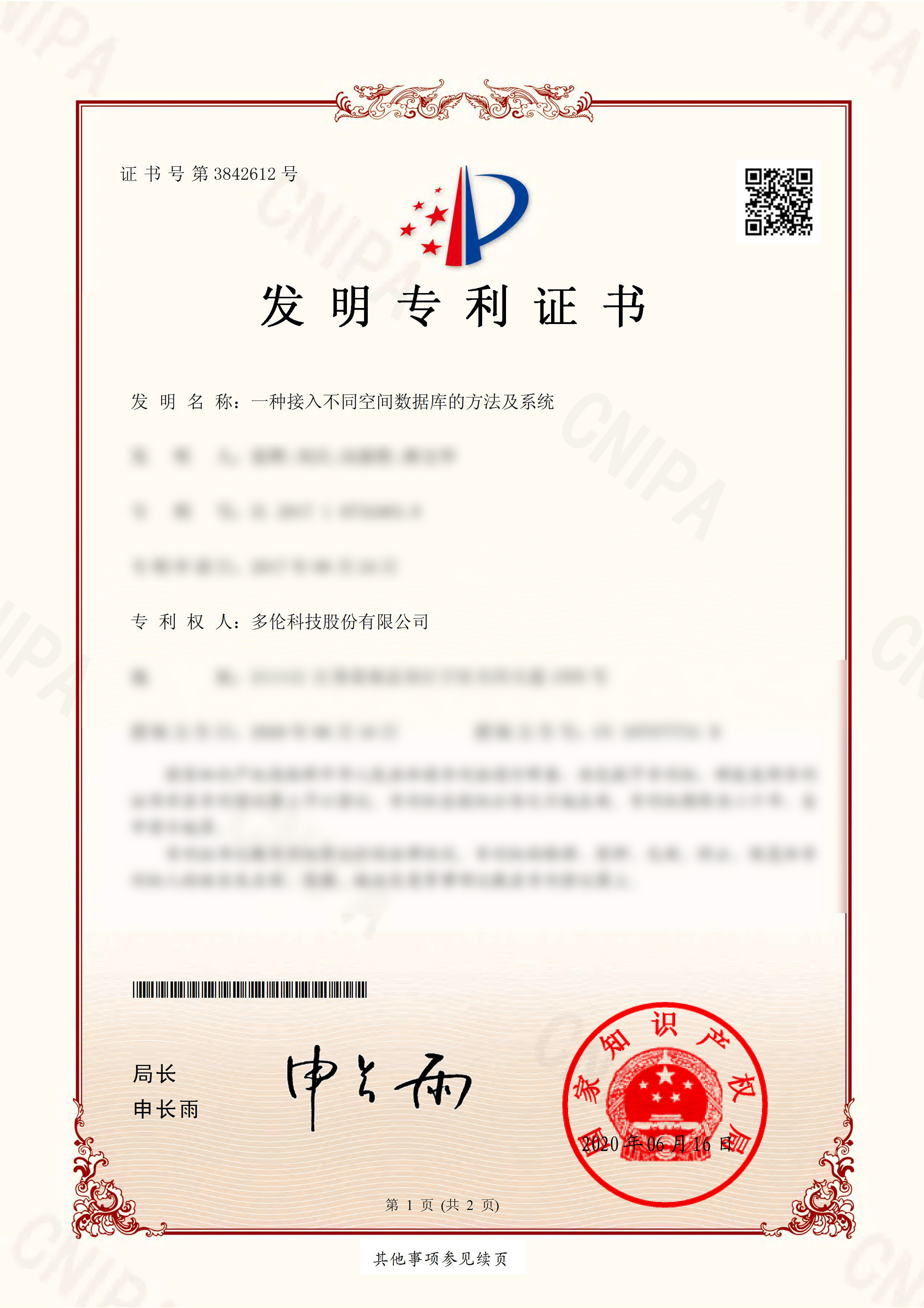
Recently, Duolun Technology has obtained a “Invention Patent Certificate” issued by China National Intellectual Property Administration, which is a method and system for accessing different spatial databases. The invention patent is mainly applied to the R&D and innovation in the field of internet of vehicles, which marks another important step forward in the development of high precision map system and the exploration in the field of internet of vehicles by Duolun Technology.

The patent name of the invention is a method and a system for accessing different spatial databases, the certificate number is No. 3842612, and the patent number is ZL 2017 1 0732483.8.
The invention discloses a method and a system for accessing different spatial databases, which belongs to the technical field of geographic information systems. The system comprises a data layer, an application layer and a service layer, wherein the data layer is used for acquiring parameters of different spatial databases, establishing corresponding configuration files according to types of the spatial databases to store the acquired parameters of the spatial databases and providing the acquired parameters to the service layer; the application layer is used for receiving parameters transmitted by a service system needing to call vector data services and transmitting the parameters to the service layer; and the service layer is used for receiving parameter information transmitted by the application layer, extracting relevant parameters in configuration texts according to the parameter information, calling syntax and spatial functions of the corresponding spatial databases to query result information, converting the result information into standard format data and outputting the standard format data to the service system. The invention solves the problem that the interface of each spatial database in the prior art is different, which needs the other developers to adapt different spatial databases before using them.

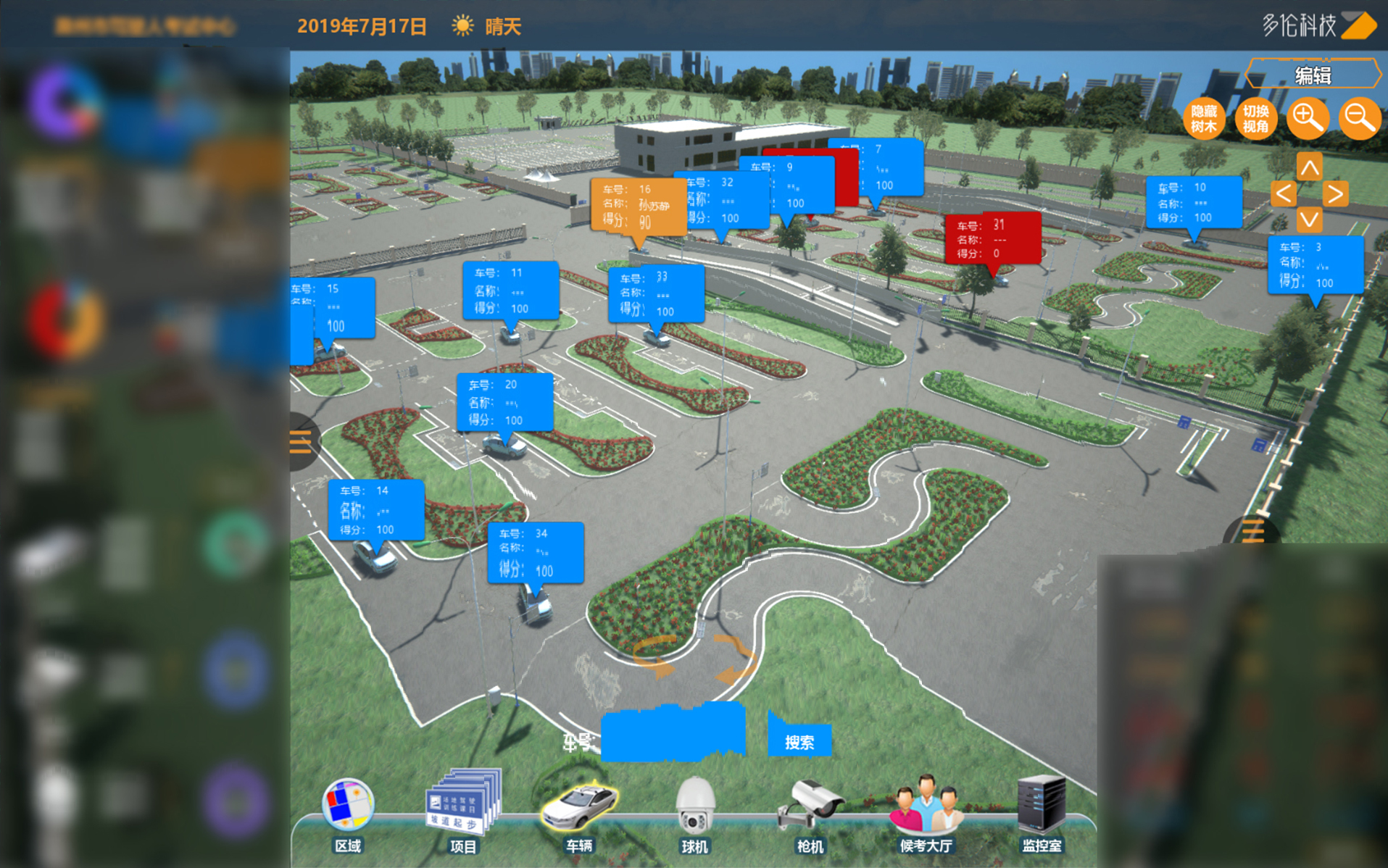
Centimeter Level High Precision GIS Map and Its Application in the Test II Test Field of Duolun Technology

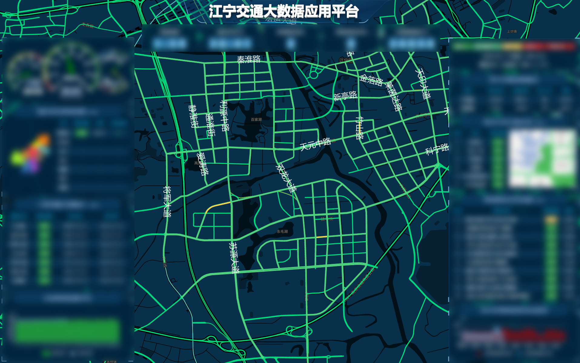
GIS Map and Its Application of Transportation City Road Network of Duolun Technology
As a leading enterprise in the field of public security transportation management science and technology, Duolun Technology has long attached importance to the R&D and industrialization of spatial information digital modeling and other aspects. At the beginning of the R&D of the smart driving test automatic research and judgment system, the company independently developed a centimeter-level high precision GIS map engine. It not only plays an important role in the smart driving test system, but also makes Duolun Technology become the leader in the field of smart vehicle management in China.
The storage and management technology of the map spatial data is the core of the high precision map system, and the patent technology of the invention developed by Duolun Technology can realize the fusion and sharing of multi-format high precision map data of different departments such as transportation, energy, land, planning and the like, build a high precision digital map infrastructure system at the city level, and provide strong support for the construction of urban global internet of vehicles applications and new digital infrastructure in other cities.
In the future, Duolun Technology will continue to strive to maintain its technological leading edge and use technological innovation to help the company's business continue to develop steadily.


 苏公网安备 32011502011140号